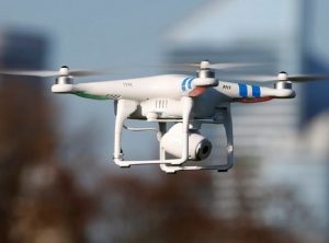
If you live in bushland around Campbelltown don’t be alarmed if you suddenly see a drone buzzing in the sky above you.
It will probably be part of Campbelltown Council’s new scientific approach to mapping the local koala habitat.
On Tuesday night the council adopted a suggestion from Cr Paul Lake to use drones or unmanned aerial vehicles (UAVs) equipped with infrared cameras to detect any koalas on the ground.
Cr Lake told council that before it adopted a proposed new plan of management of the local koala population it would be a good idea to know exactly where they were.
“At present there is no officially recognised map of where local koalas can be found in Campbelltown,’’ Cr Lake told council.
“Some people say ‘there’s koalas here or there’ but no actual map based on scientific method to show how many there are and where they are.
“But if we can map their habitat using drones that have heat seeking trackers, then we would have a better idea how to manage koalas and decide other issues relating to them,’’ he said.
“There’s no point having a management plan for koalas if we don’t know where they are.’’
Cr Lake told the South West Voice this morning that using drones would not be an expensive exercise.
“For a small cost we will have proper maps of the koala habitat and be able to make better decisions,’’ he said.
This will not be the first time drones will have been used to track koalas.
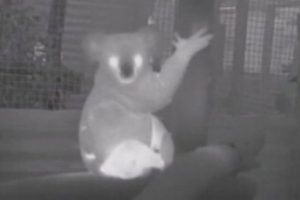
Drones fitted with infrared cameras were employed in Queensland by university researchers in 2015 to track local koala numbers.
Hovering above the tree tops, the cameras detected the animals’ body heat and beamed pictures straight back to the team of researchers on the ground.
Computer software helped distinguish koalas from other creatures that might be in the trees.
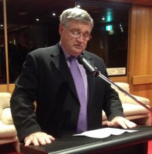
On Tuesday night, local wildlife activist Ricardo Lonza addressed the council before it voted on Cr Lake’s proposal.
Mr Lonza told the meeting that more than 30 local koalas had died in the past year, mostly as a result of urban sprawl.
“It’s time we stopped destroying the koala habitat,’’ he said.
Deputy mayor Meg Oates commended Cr Lake, saying: “I am going to support it, this is a good idea to use drones to map local koalas and their habitat.’’
♦ Other decisions at the last meeting of the year included:
• Council approving a planning proposal to rezone part of the Glenfied waste site to industrial to allow a 450,000 ton a year recycling plant, which would create local jobs. Cr Darcy Lound praised the development, saying, “this is great for our city, especially on jobs. There’s a lot of talk about jobs but in this case it will actually deliver new local jobs.’’
• Council also approved the draft Menangle Park planning proposal aimed at paving the way for around 3,400 new housing lots, employment land, a commercial centre and community facilities.
The proposal has been on public exhibition and has attracted a number of objections based on heritage and flooding issues, among other. However the council approved the plan on the basis that such concerns will be addressed at the development application (DA) stage.
• Council appointed Councillors Darcy Lound (Labor) and George Greiss (Liberal) as its representatives on the newly created Sydney South West Planning panel. The panel will determine the fate of regionally significant developments which are worth $20 million or more.